Everyone in Utah County talks about hiking Mount Timpanogos, aka Mount Timp. It’s THE HIKE to do. Everyone has a story about their experience on the hike: waking up before dawn to hike to the summit to watch the sunrise or glissading down a snow patch off to the side of the path. (Warning: this can be dangerous so we are not encouraging it). Brad and I knew we were going to hike it but wanted to wait until the weather cooled down and we were in better shape. We made the decision to hike it at the end of August.
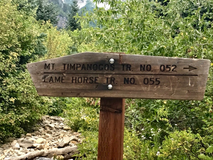
We talked about the hike all week, deciding on snacks, how much water we would need, and which of the two trails we would take. We asked around and decided to go with the Aspen Grove route in Sundance. It’s a bit steeper and shorter than the Timpooneke Trail but the views are supposedly better.
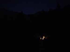
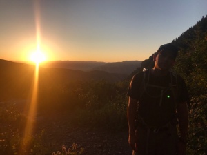
We got up at 4:30 AM on a Sunday to be at the trailhead by 6:00. Packed with 6 liters of water, extra food, sunscreen, a flashlight, hiking poles, and Advil (along with the other hiking essentials), we trekked out on the 14.6 mile-hike. We started at 4,668 feet elevation and gained 5,557 feet elevation hiking to the top. It was dark when we started, but within the hour the sun was rising over the mountains tops, making for some impressive views.
The first part of the hike was switchback after switchback and the reward was the many waterfalls along the way. I lost count of how many we saw. Some were small and some we could hear from afar before actually seeing them. The path then leveled off and we were in the heart of the mountains . . . a valley in between the mountains . . . which was amazing. We were in a place not many people saw—up thousands of feet between soaring mountaintops yet in a valley. It was such an awestruck moment. We will never forget the feeling. The meadow before us was spread wide with blooming flowers, mountain goats, and a small lake. They day had become a beautiful, sunny, perfect end-of- the-summer day.


We stopped at the lake for lunch before setting off for the hardest part of the hike.

Moving on, we came across a boulder field that was partly covered in snow, which we didn’t expect. All the reviews we’d read hadn’t mentioned snow so that part of the hike slowed us down quite a bit. We didn’t take our microspikes, but luckily we had the hiking poles. Crossing three large, slippery, snow patches covering only boulders is a little scary. I’m sure Brad could have hiked it faster if it wasn’t for me, since I’m a bit slower.
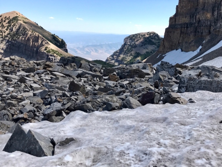
After the snow, it was up and up on loose dirt and rock to reach the part of the hike called the saddle. We were actually at one of the many tops of Mount Timpanogos, just not at the very top where the hike ends. The last mile up to the summit is at the very edge of the mountain with only a few feet to spare before the edge drops off at 10, 225 feet.


I’m not a big fan of heights (I know, surprising, right) and I’m less of a fan being up high at the very edge of a mountain. The first few yards were okay, but then I started to experience some vertigo. Seeing the flat trail in front of me and out of the corner of my eye seeing the edge of the steep mountain made me feel sick. Although it was getting windy and steeper, we kept going and then the trail changed. It was time to climb up and over rocks to get to the top. That part was too much for me.

It was freaking me out. I sat down on the rock and tried to get up multiple times to finish the last half mile or so, but I just couldn’t do it. The vertigo and exhaustion won and we started back down. We got back to the saddle and sat down until I felt better. That we’d made it all that way yet would not make it to the actual summit disappointed both of us.. However, we knew that pushing it and possibly getting injured . . . or me freaking out more and not feeling safe was not worth it.

To anyone living in or visiting Utah, this is a must hike! It was one of the best hikes we have done and was certainly one of the most challenging. So, what do we say when people ask if we hiked Timp? We say, “Yes, we did!” because we did hike it! We planned the hike for days, got up before dawn, hiked almost eleven hours straight, and were beyond exhausted when we finished.


Maybe in a few years we will go back and give it another try but for now, we are happy to look up at Mount Timp while driving and think Wow, we hiked that!


Very nice Jen
LikeLiked by 1 person
Thanks Dad!!
LikeLike
You continue to inspire me Brad and Jen!! Looking forward to your hikes and pics of 2018!!
LikeLiked by 1 person
Awe, thanks Barb. That means a lot. 💕💕
LikeLike
The pictures are Spectacular!
Makes me want to go and try to do
The hike, I know I wouldn’t be able to,but I
can dream.
Love reading your blog & seeing where you
Are and sharing in your experiences.
Be safe & careful
Love 💕 you mom
LikeLiked by 1 person
It was an awesome hike! Thanks Mom💕💕😘
LikeLike